17 Haziran 2012 Pazar

Portland is Hot, But Seattle is Cool

To contact us Click HERE
As we enter the warm portion of the year,  differences between Portland and Seattle temperatures are again becoming evident.  Seattle has a far more maritime climate than Portland and thus is considerably cooler during the summer.   In fact, the Willamette Valley as a whole has a far more continental climate than the Puget Sound basin. 

To illustrate this situation, consider some topographic maps.  Seattle is clearly open to the influence of cool waters, with Puget Sound at its front door and a sea level path to the Pacific Ocean.  With water next store and high pressure offshore, constantly pushing marine air into the Puget Sound interior, it is hard to get the Puget Sound lowlands in the 80s or 90s during the summer.  Only when we have strong offshore and downslope flow can Seattle and vicinity get toasty.

But Portland and the Willamette Valley are another story!  The Willamette River or even the Columbia is no Puget Sound, and the Willamette Valley is surrounded by mountains or high hills on all sides, thus isolating it from the marine influence during the summer--a period when the Pacific cool, marine layer is relatively shallow and unable to surmount the terrain.  Thus, it is far easier for Portland to bake...and it is not unusual for the high temperatures from Portland to Eugene to be 5-10F warmer than Seattle...sometimes much more.


Lets begin by looking at the monthly average maximum temperatures at Seattle, Portland, and Salem.
Consider July.   In that month Seattle has an average high  of 75, Portland gets to 79, and Salem, a torrid 82F.  Not need to head to Hawaii...drive down to Salem.  But look at the winter high temperatures...there is very little difference among these three stations...and that is not surprising. With strong, deep flow coming off the Pacific and lots of clouds, we all suffer with cool, wet conditions.


But the mean monthly temperatures tell only part of the story...what about the extremes? Below is a plot of daily means and  extremes...lets consider the daily extreme high temps (yellow colors).  Seattle has only gotten above 100F once---103F in July 2009.  But for Portland, daily records above 100F are numerous and above 90F commonplace over most of the summer....very different than Seattle!


Lets illustrate with last summer:  here is the plot of temperatures at Portland (green line) and Seattle (red line for July 1, 2011 to Sept 1, 2011.  Portland is warmer on virtually every day, sometimes by as much as 10F.  They just don't have Seattle's natural air conditioning.  But they do have better food trucks, several of which sell cooling drinks and ice cream.
And if you think the Willamette Valley is warm during the summer...it is nothing compared to the next basin to the south...the one including Medford and Ashland.  They laugh at 100F temps down there....but that is a story for another day, and one that includes fog during the winter.


Coal Trains: Bad for the Northwest Environment

To contact us Click HERE
There has been a lot of discussion about  to greatly increase the number of coal trains passing through Washington State, trains that would move coal mined in Wyoming and Montana to ports where it would be loaded on to ships destined for Asia.   A number of local groups are opposing this idea and recently the Seattle City Council voted for a motion against the trains.


Folks,  coal trains and coal export to Asia are poor ideas and bad for the environment on a number of levels.  

Those who have read this blog know I am no global warming radical...and on a number of occasions I have spoken against those exaggerating the local threat of increased greenhouse gases.  But anthropogenic (man-caused) global warming is a very serious issue and the earth will warm considerably during the next 50-100 years because of increasing CO2 and other greenhouse gases (e.g., methane). Coal is one of the worst fossil fuels, in terms of production of CO2 per unit heat produced, and it is dirty, resulting in lots of particles and toxic gases in the atmosphere.

So here we are in the U.S, driving our hybrid cars, expending large amounts of money on renewable energy sources, insulating our homes and business, and working in a dozen other ways to lessen our carbon footprint.   And at the same time we plan to mine tens or hundreds of millions of tons of coal a year and ship it to China?  This makes no sense.   And it costs energy--lots of energy--to ship the coal to our ports and then across the widest ocean in the world, and then to move it to where it is needed in Asia.

But is is far worse than that.  Each coal car is a huge source of coal dust--Burlington Northern estimates about 500 lb of coal dust is lost per car during the trip.   Thus, we also have a substantial local public health problem as local communities near rail lines are covered by a veil of particulates that can cause serious respiratory problems for those with asthma and other health issues.  In fact, some of us at the UW are sufficiently interested in this that we plan on measuring these dust levels over the summer as some of the coal trains lumber by.  And the diesel trains that  pull all these coal cars are THEMSELVES big pollution sources....diesel engines produce a toxic collection of substances that irritate the lungs and even cause cancer.

Want to see the coal dust blowing off a coal train? Click on this image to see a video of a coal train in British Columbia...you will see HUGE amounts of dust blowing off into a scenic river basin:

 http://www.youtube.com/watch?v=jixOquzgNqk
Even worse...once the coal gets to China they burn it, producing all sorts of particulates and gases that then moves across the Pacific to worsen regional air quality problems here in the Northwest.  In fact, Professor Dan Jaffe, of UW Bothell, has documented the substantial contribution of Asian pollution to our background pollution levels (see here for one story on this).

So coal trains will greatly contribute to increased global warming and will undermine the health of Northwest residents both from the coal dust blowing off trains and the air pollution that the coal will produce in Asia and which will blow back across the Pacific into our area.

And one more thing---more coal trains will lead to more traffic in many Northwest cities, since there are numerous train crossings on major local roads.


I know what some of your are thinking....if we don't supply the coal, the Chinese will just purchase it elsewhere--with the same impact on global warming and cross-Pacific pollution.  And we lose a big sale!

 I just don't buy it. China is choking is its own pollution, reducing the lifespan of its citizens.  They need encouragement to move away from dirty coal, and facilitating their dependence on this fuel so we can make some money is ethically unacceptable.  You can make good money selling drugs to the addicted, but is it the right thing to do?  Certainly not.  There is a lot of talk about "Clean Coal" in the coal industry, but it is all hype--coal is dirty and no one has developed a technology that can economically remove the CO2 or lessen the air pollution problems it produces.


 Here is the U.S., we are slowly weaning ourselves from coal, particularly as natural gas becomes so cheap and renewable energy is becoming more widespread.  I believe the world is making a major mistake in moving away from nuclear energy.   Nuclear power can be accessed in a safe, clean way and the dumb mistakes of previous installations should not prevent it from taking a valuable role in providing massive amounts of power during our transition to renewable sources.  Yes, radiation is a danger, but so are the proven health and greenhouse warming dangers of burning fossil fuels.  Here is a figure relating the death rates per unit energy for coal, oil, and nuclear, based on statistics found here:
I have looked at a number of sources, and the results are consistent:  nuclear, even with the mistakes made at some locations, is far safer than burning fossil fuels.

Feeling a bit tropical outside?

To contact us Click HERE
Seems a bit humid?   More like the East Coast in summer than our normally low relative humidity?

The dew points...a good measure of the moisture in the air...are quite high today, reaching into the lower to mid 60s right now (around 2 PM Saturday).

Here are the current dew points at some local stations--no lack of 60s!


And with temperature in the low 70s, the relative humidities are quite high, with plenty of locations above 80%:


No wondering I am sweating so much while I am working in my garden today!

Typical dew points around here in the spring and early summer are more typically in the mid 40s.   Lets illustrate with Olympia, where the dew point is now 63F. This plot shows the dew points for the past 12 weeks.  Today is highest, with one time in early June getting to 62.

 To be so warm, with lots of clouds, and such high humidity means only one thing....tropical or subtropical air has reached us.  To illustrate this, here is the vertically integrated water vapor in the atmosphere forecast to occur at 2 PM today (Saturday):

 You can see the "atmospheric river" of moisture approaching us from the southwest.  Tomato plants love this kind of weather.

Don't like warmth and high humidities?   No worry.  This tongue of warmth and moisture is only transitory and will head south of us tonight (map at 5 AM below):


Time to break the bad news to my tomato plants.

14 Haziran 2012 Perşembe

Where to See the Transit of Venus?

To contact us Click HERE
Update Monday evening:  Sequim and vicinity might be a possibility.

Tomorrow, from around 3:09 PM to sunset, Venus will move in front of the sun---the famous transit of Venus.   This is an extraordinarily rare event that will not occur again for over a century (December 11, 2117).

The problem is that a weather system will pass through the region tomorrow morning and afternoon...but there appears to be a chance that some NW residents will see it.

Bottom line:  for Puget Sound residents, head for the southern Washington coast or Oregon coast for maximum chances of viewing.  Westport might be the closest location that is viable for Seattle residents.  Or head south to Longview/Portland.

I don't have much time right now...but here are some of the model graphics, indicating cloud cover.  First, cloud forecasts for 2, 5, and 8 PM.


 Portland and northwest Oregon may luck out.  There is some uncertainty with these forecasts...lets see what tonight's runs show.

Here is the official National Weather Service sky cover percentages for 5 PM and 8 PM:


Venus Transit Update

To contact us Click HERE
8 AM Update: The Oregon coast has opened up into scattered clouds. Here is the satellite image:

The inland band will slowly move out.   

Further updates at 11 AM when all the model output is in.  The big question for all transit lovers....head to Sequim or the coast?


I am getting a bit more optimistic that many of us will see the transit...or be able to view it with a modest drive.   Each forecast run is clearing out more...particularly on the coast.  Here are the cloud fields from the UW WRF model for 5 PM tomorrow...the first shows liquid water cloud content, the other, the simulated satellite view.  The coast is generally clear...and even Sequim looks like a possibility.  There appears to be a convergence zone over the central Sound...not good. 


So if you want to have a good chance of viewing the transit--head to the coast.  If you can't go that far, head to Sequim, north Whidbey Island, or down to Olympia.

No guarantees....but looking better.   More information tomorrow AM....cliff

Venus Transit Weather Update

To contact us Click HERE
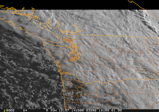
The clouds are thinning over the Northwest  and the biggest improvement is along the coast.  Here is the latest visible image at 11:40 AM:


There is an enhanced area of showers going into the Washington coast, but that will be through by 3 PM.  I am encouraged that the showers are suppressed offshore.  If you are on the coast...go ALL the way to the coast...to the waterline...should be less clouds there.  Any there will be clouds and sun..so you can see the transit in the gaps. Eastern Oregon seems to be opening up now as well.

Weak convergence is keeping the central Sound cloudy with some showers...these should lessen during the afternoon but still should be a problem.  The latest 4/3 km WRF run also suggest that the Sequim/N. Whidbey island/San Juan area should be open, and perhaps the far south Sound (e.g., Olympia).  In fact, the area south of Tacoma, might be a  good bet if you want someplace close to SEA...it is in the lee of the Olympics.


Good luck...this is an extraordinarily rare astronomical event.

Ocean Full of Clouds

To contact us Click HERE
Sometimes during springtime one looks at the visible satellite imagery over the eastern Pacific and can't help but be impressed that nearly the entire ocean is covered by low clouds.  This morning provides a prime example:

 Pretty amazing.   You have to feel sorry for those poor mariners crossing the ocean with day and day of low clouds (mainly stratocumulus).  Even central and southern California coastal residents are in the murk and you can see the low clouds spreading to the crest of the Oregon and Washington Cascades.  Folks, this is what June gloom looks like from space.

You see the checkerboard pattern over the ocean?  Those are ship tracks....the result of the effluent from fossil fuel burning ships.  The particles from combustion result in more condensation nuclei and more water droplets.  More droplets results in more of the sun's rays being reflected back to space.  Here is a close-up view. You can see why the U.S. Navy likes nuclear ships...no ship tracks!


To illustrate the murk at ground level, here are the latest webcams at Cannon Beach Oregon:


and at Del Mar near San Diego.


Kind of makes a Northwestener feel better...we have have company.

The ironic thing about this extensive shield of low clouds is that it is the result of HIGH PRESSURE.
Don't believe me?   Well, here is the proof...the 6-h forecast for sea level pressure over the eastern Pacific.  A huge high pressure area dominating the eastern Pacific, while low pressure is found over the southwest U.S..  Between the two there is a large difference in pressure near the Oregon/CA border...which produces very strong winds there (described in a previous blog).


High pressure produces sinking air and sinking causes warming. The sinking decreases as the air approaches the surface.  So with strong warming aloft and cool water near the surface we end up with an inversion (warming with height) in the lower atmosphere.   So we have a veneer of cool, moist air (with lots of low clouds) near the surface and dry warm air aloft.  Here is the latest sounding from Quillayute on the Washington coast (red is temperature, blue is dewpoint)... this structure is really obvious.
 The vertical axis is pressure.  850 hPa is roughly 5000 ft.  Where the temperature and dewpoint are on top of each other we have a saturated (cloud-full) environment.  Here is a similar figure for San Diego (no color coding of lines).  Same structure.


So the secret of getting away from the low clouds is either to go above roughly 3-5 thousand feet (good if you own a helicopter or can hike up a local peak) or cross the Cascades.  Sorry.