 |
| MODIS satellite image on August 12th |
Let me give you some recent examples. Here is the latest National Weather Service sea surface temperature (SST) analysis for today...notice the cold temperatures from San Luis Obispo on the southern CA coast to our area, with the coldest temps along the northern CA coast.
 We can take a closer look off the Oregon coast by viewing the SSTs forecast by the Oregon ROM ocean modeling system (I used the NANOOS web site to plot this). Lower to mid-50s along the coast while lower 60s are waiting 100 miles offshore.
Or take a look at the last NOAA SST analysis for the NW coast. A veneer of cold water follows the coast.

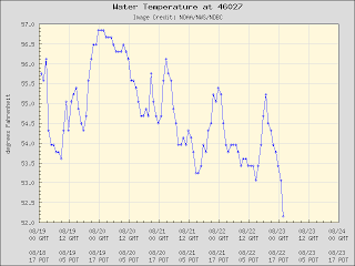
Buoy 27 is found right off the Oregon/CA border and temperatures there have been dropping into the lower 50s.
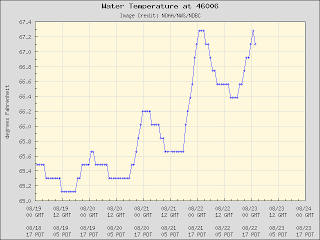
 But head out to Buoy 46006 and temperatures in the in sultry mid to upper 60s.
The offshore water is warm enough for albacore tuna, so a number of Washington and Oregon fishing charter companies head offshore 10-30 miles to give anglers a chance to bring in some tuna.
 |
| Image courtesy of Deep Sea Charters, Inc. of Westport |

Hiç yorum yok:
Yorum Gönder