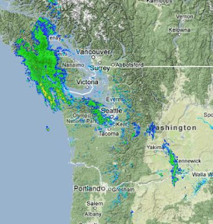
Here is a recent radar...you can see where the showers are:

The next issue will be the return of the northwesterly winds to Cle-Elum/Ellensburg. Take a look at the 4/3 km high resolution UW forecasts for tomorrow AM and tomorrow night. These are sustained winds..not gusts. The last figure is for 8 PM Sunday night...and the winds will be really cranking by then, with sustained winds of 20 knots in places.


Hiç yorum yok:
Yorum Gönder